Objecting to Planning Applications on Flood Risk Grounds
In the United Kingdom, flood risk has become a central issue within the planning system. With climate change contributing to an increase in extreme weather events, the risk of flooding has grown, affecting communities nationwide. As planning applications are submitted for new developments or changes to existing ones, concerned citizens, local authorities, and organizations often find themselves needing to lodge a flood risk planning objection UK. This comprehensive guide provides a detailed overview of objecting to planning applications on flood risk grounds in the UK—exploring legal frameworks, grounds for objection, the application assessment process, and practical advice for those wishing to engage with the system.
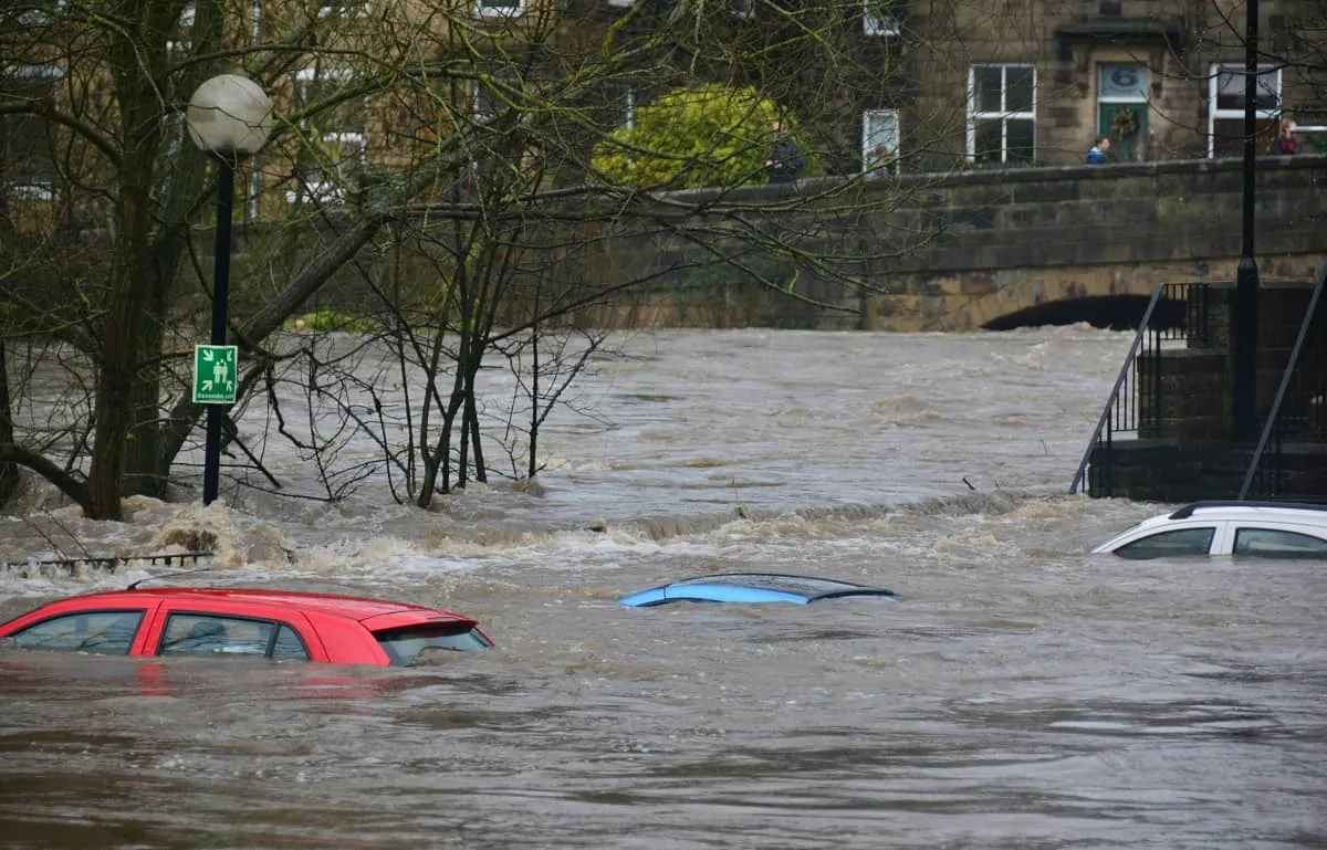
Why Is Flood Risk a Planning Issue?
The UK frequently faces flooding from various sources, including rivers, the sea, surface water, and groundwater. Flooding can cause profound economic loss, property damage, and in severe cases, loss of life. With more than 5.2 million properties in England alone at risk of flooding, it is crucial for the planning system to manage and reduce this risk.
The planning system serves as a first line of defence by ensuring new developments do not exacerbate flood risk—either to the site itself or to neighbouring areas. National planning policy requires that flood risk be considered at every stage: from site selection to detailed design. This is why a robust system exists for objecting to planning applications that may pose a flood risk.
The Legal & Policy Framework Governing Flood Risk in Planning
Several key policies and regulations shape how flood risk is handled within the UK’s planning regime:
- National Planning Policy Framework (NPPF): The NPPF sets out the government’s policies on development and flood risk. It requires that inappropriate development in areas at risk of flooding be avoided, directing development away from such areas wherever possible.
- Planning Practice Guidance (PPG): Flood Risk and Coastal Change: Offers further details on how flood risk should be assessed within the planning process.
- Local Plans and Strategic Flood Risk Assessments (SFRAs): Local planning authorities must account for flood risk within their own plans, informed by evidence and modelling.
- Environment Agency’s Statutory Role: The EA is a statutory consultee on planning applications that present a flood risk. Its advice can be pivotal in the determination of applications.
- Relevant Legislation: Flood and Water Management Act 2010, The Town and Country Planning Act 1990, and associated regulations underpin legal obligations related to flood risk.
Understanding Flood Zones and Their Importance
The Environment Agency categorizes land in England and Wales into different flood zones based on their risk level:
- Flood Zone 1: Land with a low probability of flooding (less than 0.1% annual chance).
- Flood Zone 2: Medium probability (between 0.1% and 1%).
- Flood Zone 3a: High probability (over 1% annual chance).
- Flood Zone 3b: The functional floodplain, where water must flow or be stored in times of flood.
Most new residential developments are steered away from Flood Zone 3 unless an exceptional case can be made, typically involving detailed flood risk assessments and passing key policy tests.
How the Planning System Assesses Flood Risk
All planning applications that may be affected by flooding, or increase flood risk elsewhere, must be supported by a site-specific Flood Risk Assessment (FRA). The level of analysis required depends on the flood zone and the nature of the development. Where risk is deemed significant, further regulatory hurdles—such as the Exception Test or Sequential Test apply.
- Sequential Test: Determines whether there are reasonably available sites in lower flood risk areas.
- Exception Test: Applied if the Sequential Test cannot be satisfied, requiring the development to demonstrate wider sustainability benefits and be safe from flooding for its lifetime.
The Environment Agency and Lead Local Flood Authorities (LLFAs) play significant roles, reviewing FRAs and offering specialist advice. If their concerns are not addressed, they may raise objections themselves.
Grounds for Making a Flood Risk Planning Objection in the UK
When objecting to a planning application on flood risk grounds, the objection must be based on material planning considerations—matters the local planning authority is legally obliged to take into account. Common grounds linked to a flood risk planning objection UK include:
- Unacceptable increase in flood risk to third parties, such as neighbouring properties or roads;
- Insufficient or inadequate Flood Risk Assessment (FRA);
- Non-compliance with the Sequential or Exception Test;
- Lack of suitable flood mitigation measures;
- Evidence that sustainable drainage systems (SuDS) have not been appropriately considered;
- Contradiction with local or national planning policy on flood risk;
- Omission or downplaying of flood events or data within the developer’s submissions;
- Failure to consult statutory consultees or properly address their comments.
Merely raising concerns or opposition is not enough. Effective objections should reference planning policies, provide evidence, and clearly explain the anticipated impact of the proposal.
Who Can Make a Flood Risk Objection?
Any member of the public, neighbouring landowners, local community or environmental groups, parish councils, or statutory consultees (such as the Environment Agency) can file a flood risk planning objection UK. The process is open, inclusive, and offers a valuable way for communities to express legitimate concerns.
Most objections are made during the statutory consultation period, which usually lasts 21 days after a planning application is validated and publicised. Late objections may still be considered if a decision has not yet been made.
Where to Find Planning Applications and How to Object
All planning applications are published by the relevant Local Planning Authority (LPA) typically your local council. Applications can usually be viewed online using the council’s planning portal, with key documents such as planning statements, site plans, FRAs, and environmental reports available for download.
To lodge an objection:
- Locate the application on the LPA’s website.
- Review all available flood risk information and supporting documentation.
- Submit your objection through the portal or by email/letter, ensuring you reference the application number, address, and precise grounds of objection.
Some LPAs offer online forms; others prefer emails or written letters. Always check the procedures on your local council’s planning website.
How to Structure a Flood Risk Planning Objection
A well-structured flood risk planning objection should contain:
- Your details: Name, address, and, if applicable, any organisational affiliation.
- Clear reference to the application: Planning application reference number, address, description of proposal.
- A summary of your objection: One paragraph summarising the main concern (i.e., “The proposal fails to appropriately account for flood risk, threatening nearby homes with increased surface water runoff…”).
- Detailed grounds: Subsections addressing various issues, such as inadequate FRA, policy non-compliance, insufficient mitigations, or procedural shortcomings.
- Reference to policy and evidence: Cite the NPPF, local plan policies, Environment Agency guidance, or technical data. Attach supporting photos, maps, or reports if you have them.
- A clear conclusion: State the outcome you seek (e.g., refusal of the application, requirement for further flood risk assessment).
Keeping the tone objective and evidence-based will maximise its effectiveness.
Common Types of Flood Risk Objections
Flood risk objections can relate to many sources and pathways of flooding:
- Fluvial flooding: From rivers or streams, especially where channel capacity is reduced by development.
- Surface water flooding: Often exacerbated by hard surfacing or inadequate drainage methods (e.g., loss of permeable ground, lack of SuDS).
- Groundwater flooding: Particularly a risk in regions with high water tables or certain geological conditions.
- Drainage system overloading: Development may overwhelm existing foul or surface water sewers.
- Coastal flooding: For applications near the sea, lack of adequate sea defences may be a relevant issue.
- Floodplain encroachment: Building on active floodplains reduces their capacity to absorb and slow floodwaters.
Making Effective Flood Risk Planning Objections
Planning objections on flood risk grounds are most effective when they are clearly evidence-based and firmly aligned with national and local planning policy. As outlined in this guide, decision-makers place significant weight on whether a proposal adequately addresses flood risk through proper assessments, mitigation measures, and compliance with frameworks such as the Sequential and Exception Tests.
While development remains necessary to meet housing and economic needs, proposals that increase flood risk, fail to incorporate sustainable drainage solutions, or do not properly consider their wider impact on surrounding areas can justifiably be challenged through the planning system. Well-prepared objections that highlight deficiencies in Flood Risk Assessments, policy conflicts, or risks to neighbouring properties can influence outcomes, lead to design revisions, or result in refusal where harm is substantial.
Contact Charrette Law today to discuss your case with our expert team and receive tailored advice on preparing a strong, policy-based objection. Whether you are responding to a current application or reviewing a development proposal in your area, we are here to guide you through every stage of the planning process.